TEST Highway Map of the County of Santa Clara

Title

TEST Highway Map of the County of Santa Clara

Creator

Blow, Ben

Subject

Map
Highways
Santa Clara County
Roads

Description

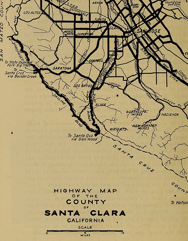
A hand-drawn map of the highways and major roads in Santa Clara County from 1920.

Publisher

San Francisco
Library of Congress

Contributor

Sienna Pearson

Date

1920

Type

Image
Map

Transcription

Text Appearing Before Image:
rafficwhich the roads of Santa Clara County bear is that pleasuretravel which, with the cheapening of the automobile, hasincreased so tremendously of late years. Of this travelSanta Clara County invites and secures its full share, whichis poured in by the State Highway from San Francisco andOakland, two main trunk line highways originating at thesepoints converging at San Jose, the commercial center of thecounty, into one main trunk line that reaches the cities andvalleys to the southward by way of the Coast route. Of the pleasure traffic which passes through Santa ClaraCounty there is a definite and natural diversion, for manypoints of interest exist made easy of access by county high-ways. Principal of these is the famous Lick Observatory,the gift of James Lick, one of Californias pioneers, whosewill set aside $700,000 for an observatory to be equippedwith the finest and most powerful telescope obtainable. (241) To San MateoSan Francisco SAN FRANCISCO BAY To Nilgy Hayward, tfi. mmm.
Text Appearing After Image:
To Santa Quz ▼ V-^via Glen Mod I v-.^- HIGHWAY MAP OF THE COUNTY SANTA CLARA CALIFORNIA SCALE O 5 10MILES With the exception of the Sky-line Boulevard and the Pacheco Pass route of the State High-way all highways shown are completed. ALAMEDA COUNTS (243)

Files

Santa_Clara_County_highway_map,_1920s.jpg

Citation

Blow, Ben, “TEST Highway Map of the County of Santa Clara,” Santa Clara University Digital Exhibits, accessed May 2, 2024, https://dh.scu.edu/exhibits/items/show/4690.

Output Formats

Embed

Copy the code below into your web page

Item Relations

This item has no relations.