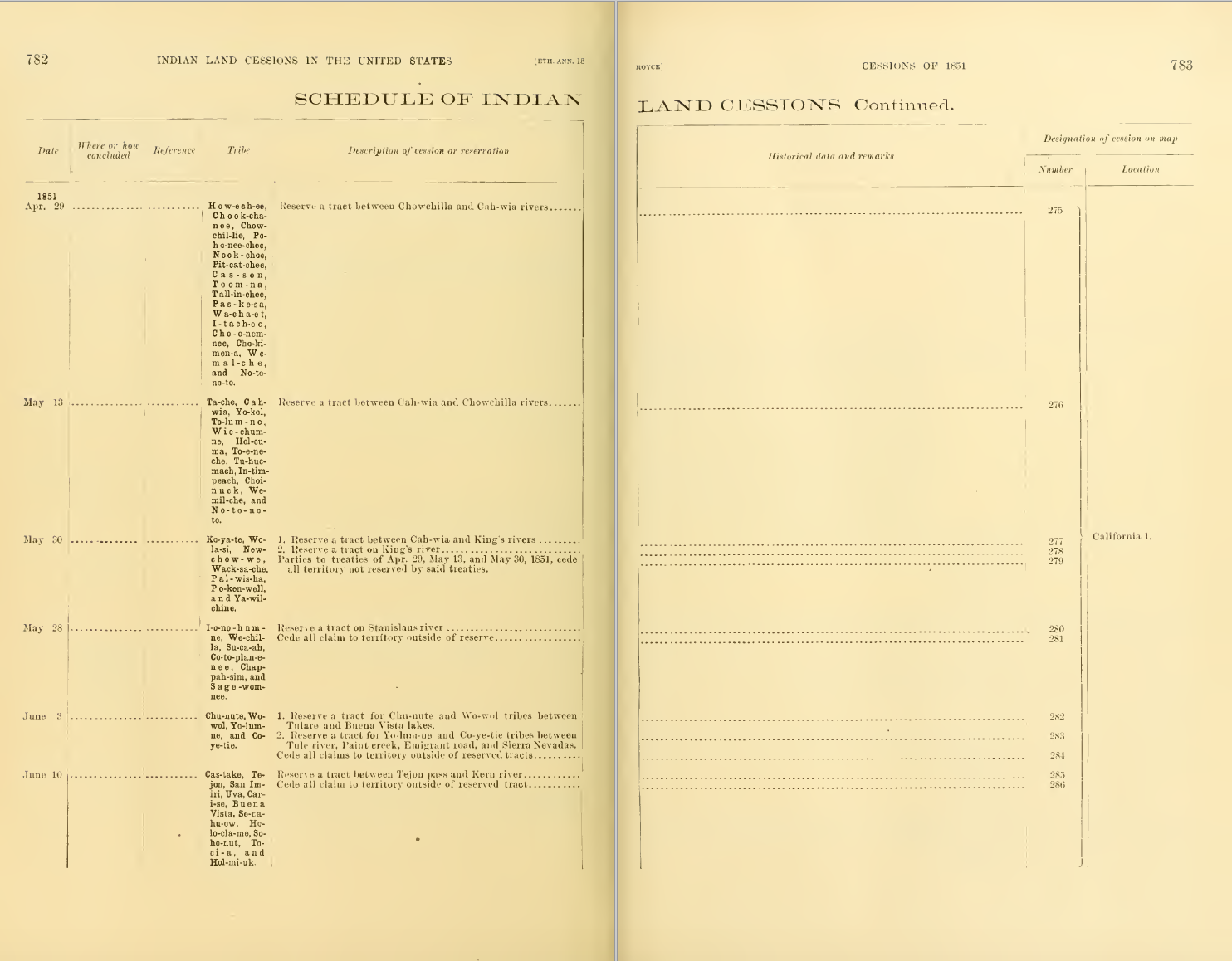
Koyate, Wolasi, Newchowwe, Wacksache, Palwisha, Pokenwell, and Yawilchine land taken in 1851 (ceded by the state of California)
Title
Koyate, Wolasi, Newchowwe, Wacksache, Palwisha, Pokenwell, and Yawilchine land taken in 1851 (ceded by the state of California)
Creator
Compiled by Charles C. Royce; Directed by J.W. Powell; Bureau of American Ethnology
Subject
Land taken from Native Americans in the United States, 1846-1851
Description
A dated list, plus maps, of areas detailed as "cessions"—Native American Land taken by the United States government across the United States between 1846-1851; names the tribes residing on the land previously and the State to which the land was ceded, with other short notes and cartography; on May 30, 1851, land of the Koyate, Wolasi, Newchowwe, Wacksache, Palwisha, Pokenwell, and Yawilchine was ceded (cession #279) to the State of California
Publisher
Washington Government Printing Office
Contributor
Cyrus Thomas
Date
1899
Type
Image
Format
Image
Identifier
IndianLandSessionsSantaClara1851.jpg
Source
Statistical Department Boston Public Library; Invasion of America map http://usg.maps.arcgis.com/apps/webappviewer/index.html?id=eb6ca76e008543a89349ff2517db47e6
Language
English
Relation
Secretary of the Smithsonian Institution
Coverage
Central Valley, California
Rights
NOT_IN_COPYRIGHT
Files
Collection
Citation
Compiled by Charles C. Royce; Directed by J.W. Powell; Bureau of American Ethnology, “Koyate, Wolasi, Newchowwe, Wacksache, Palwisha, Pokenwell, and Yawilchine land taken in 1851 (ceded by the state of California),” Santa Clara University Digital Exhibits, accessed June 17, 2026, https://dh.scu.edu/exhibits/items/show/2150.
Item Relations
This item has no relations.