Mission-era landscape overlay on modern Santa Clara University campus (Map)
Title
Mission-era landscape overlay on modern Santa Clara University campus (Map)
Creator
Lee Panich; Sydney Olson, Will Berg, Zach Panoplos
Subject
Mission Santa Clara; Adobe Lodge; North Parking Garage Structure; Excavation; Historical Archaeology; Franklin Block 448 Project
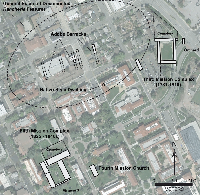
Description
An overhead view of Mission Santa Clara at Santa Clara University depicting the current buildings on campus and image overlays of previous places and areas of the ranchería.
Publisher
Santa Clara University, Community Heritage Lab
Contributor
Sydney Olson, Will Berg, Zach Panoplos
Date
2015
Type
Map
Format
PNG
Source
Mission Santa Clara in a Changing Urban Environment Article (2015)
Language
English
Coverage
The Native American Rancheria at Mission Santa Clara de Asis; 1777-1836; Franklin Block 448 Project 2003-2014
Files
Collection
Citation
Lee Panich; Sydney Olson, Will Berg, Zach Panoplos, “Mission-era landscape overlay on modern Santa Clara University campus (Map),” Santa Clara University Digital Exhibits, accessed June 29, 2026, https://dh.scu.edu/exhibits/items/show/2239.
Item Relations
This item has no relations.