Map of the Anza Expedition 1775-1776
Title
Map of the Anza Expedition 1775-1776
Creator
National Park Service
Subject
Juan Bautista de Anza Expedition
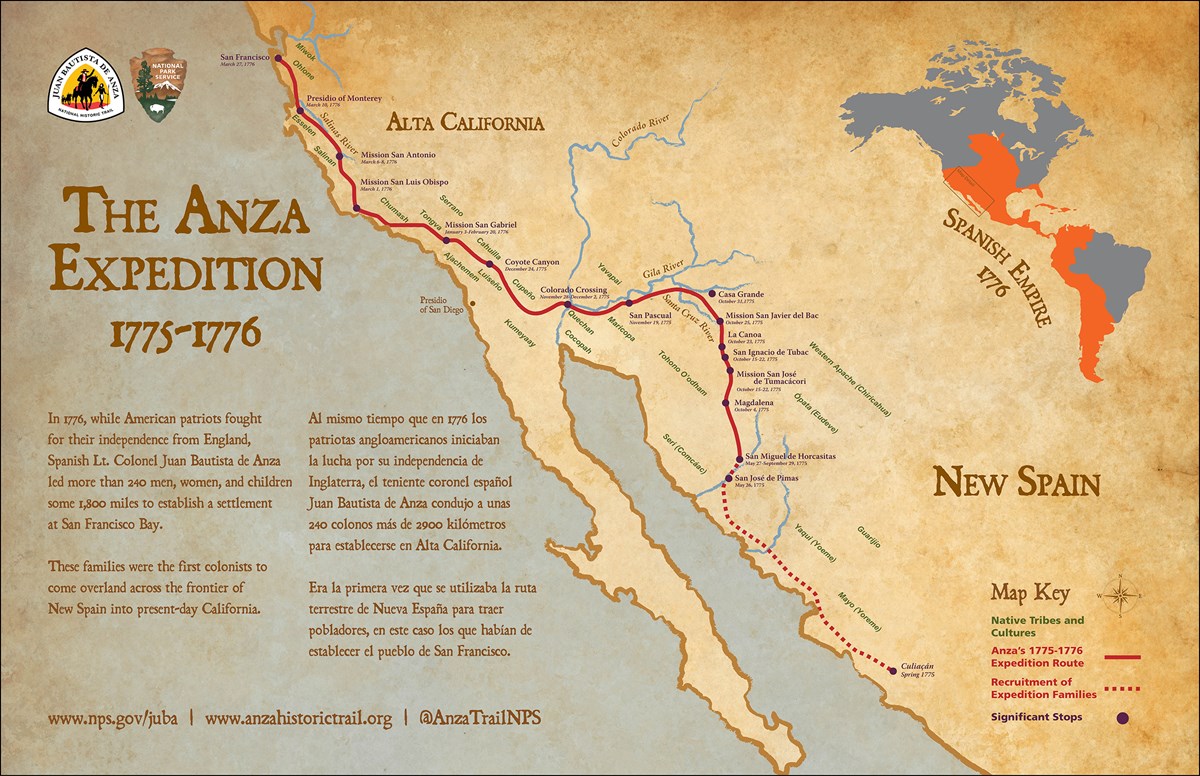
Description
Map showing the path of Juan Buatista de Anza's 1775-1776 expidition of Alta California.
Publisher
United States National Park Service
Type
Image
Format
JPEG
Identifier
Anza-Expedition-Map-Banner.jpg
Source
https://www.nps.gov/juba/planyourvisit/maps.htm
Language
English
Spanish
Coverage
Rights
United States National Park Service
Files
Collection
Citation
National Park Service, “Map of the Anza Expedition 1775-1776,” Santa Clara University Digital Exhibits, accessed June 17, 2026, https://dh.scu.edu/exhibits/items/show/2258.
Item Relations
This item has no relations.