Spearman's Santa Clara Missions over time map
Title
Spearman's Santa Clara Missions over time map
Creator
Arthur Spearman, S.J.
Subject
Map of Santa Clara Missions over time
Description
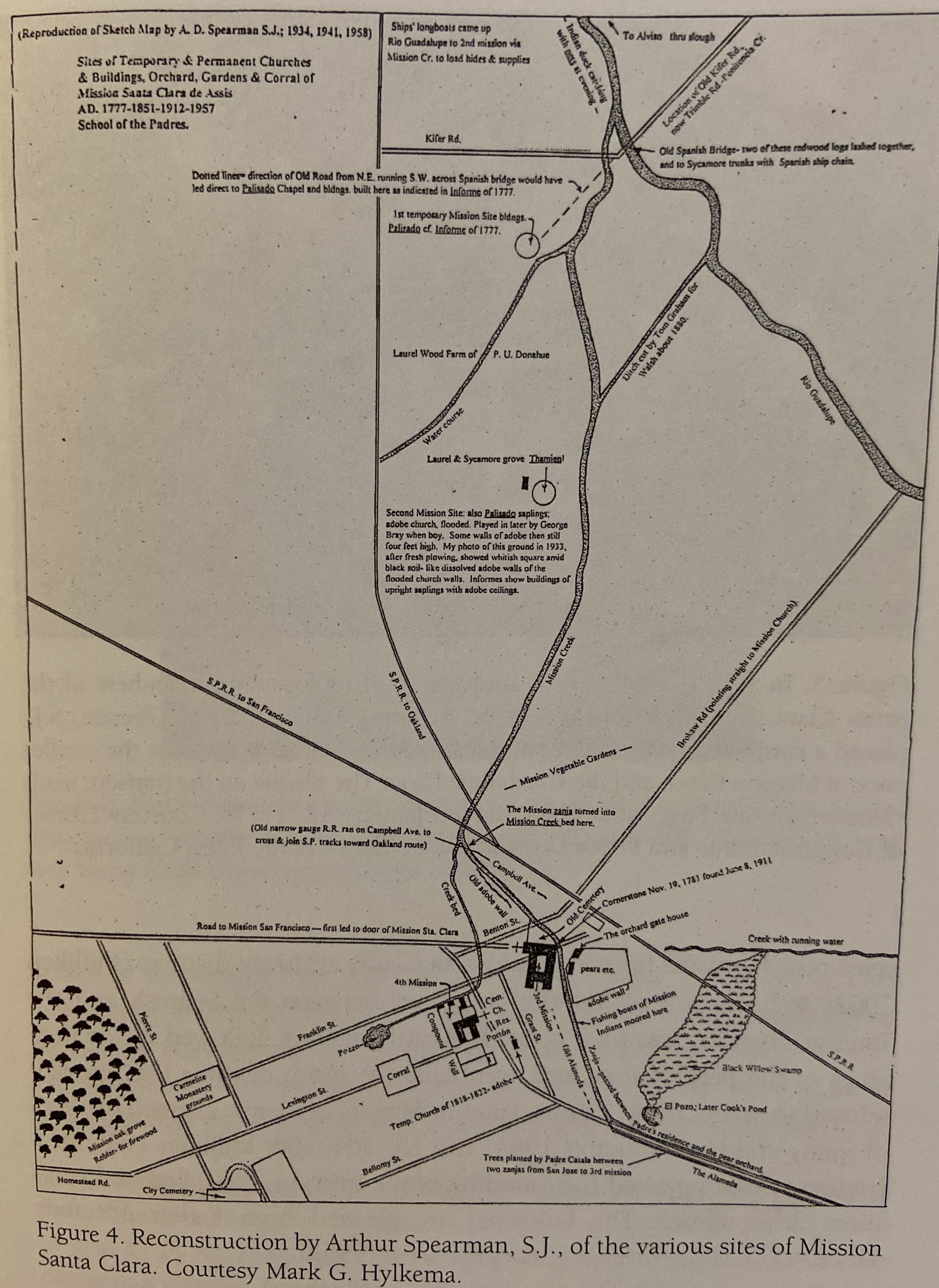
Map of Santa Clara Missions over time drawn put together by Jesuit Arthur Spearman, S.J.; shows each location of the Missions (as known at Spearman's time, more as been discovered since)
Publisher
Academy of American Franciscan History
Contributor
Mark G. Hylkema; Russel K. Skowronek
Type
Image
Format
.jpg
Identifier
Spearman's Santa Clara Missions over time map.jpg
Source
Skowronek, Russel K. Situating Mission Santa Clara de Asís: 1776-1851, Documentary and Material Evidence of Life on the Alta Frontier: A Timeline. Academy of American Franciscan History, 2006, pp. 27.
Language
English
Relation
Hylkema, Mark G. Archeological Investigation at Mission Santa Clara (CA-SCL 30) for the Re-Alignment of Route 82. California Department of transportation, District 4, Oakland, 1995.
Coverage
Santa Clara, California; San Jose, California
Files
Collection
Citation
Arthur Spearman, S.J., “Spearman's Santa Clara Missions over time map,” Santa Clara University Digital Exhibits, accessed June 17, 2026, https://dh.scu.edu/exhibits/items/show/2319.
Item Relations
This item has no relations.