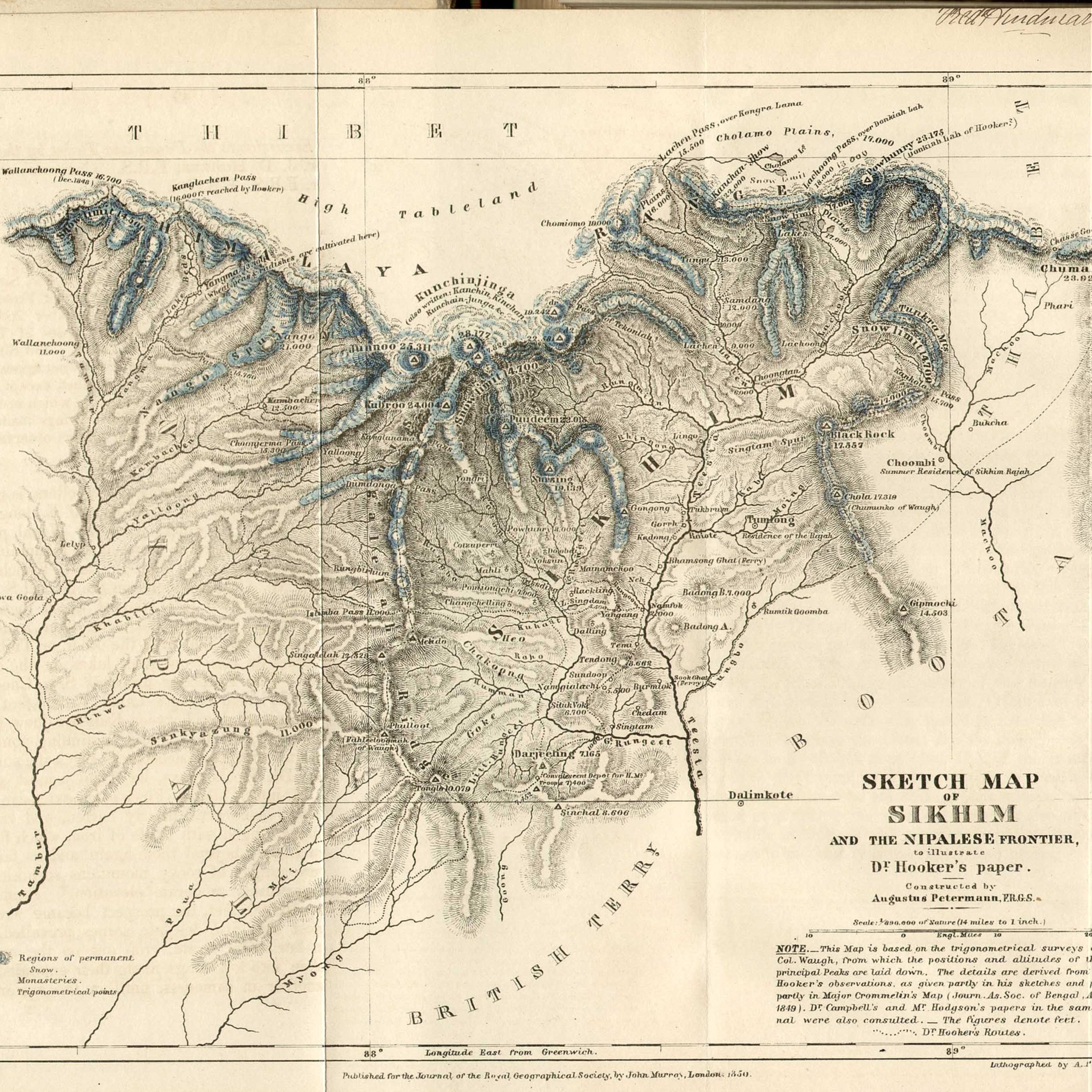
Sketch Map of Sikhim and the Nipalese Frontier to illustrate Dr. Hooker's paper
Title
Sketch Map of Sikhim and the Nipalese Frontier to illustrate Dr. Hooker's paper
Creator
Petermann, Augustus
Description
Constructed by Augustus Petermann, F.R.G.S.
Scale: 1/890,000 of Nature (14 miles to 1 inch.)
Note: This Map is based on the trigonometrical surveys or Lt. Col. Waugh, from which the positions and altitudes of the principal Peaks are laid down. The details are derived from Dr. Hooker's observations, as given partly in his sketches and papers partly in Major Crommelin's Map (Journ. As. Soc. of Bengal, August 1849) Dr. Campbell's and Mr. Hodgson's papers in the same Journal were also consulted. The figures denote feet.
Dotted lines indicate Dr. Hooker's Routes.
Publisher
Survey of India
Date
1851
Source
https://commons.wikimedia.org/wiki/File:1851_Sikhim_map_to_illustrate_Hooker%27s_paper.jpg
Citation
Petermann, Augustus, “Sketch Map of Sikhim and the Nipalese Frontier to illustrate Dr. Hooker's paper,” Santa Clara University Digital Exhibits, accessed January 28, 2026, https://dh.scu.edu/exhibits/items/show/2724.
Embed
Copy the code below into your web page
Item Relations
This item has no relations.
