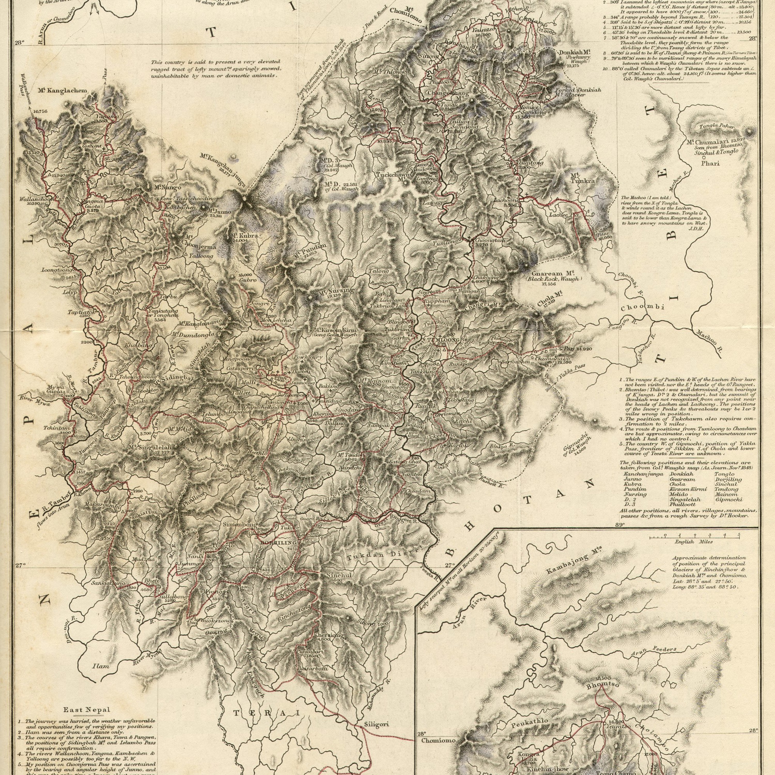
Map of Sikkim and Easter Nepal by J. D. Hooker, Esq., M.D.R.N, F.R.S., Shewing His Routes (English miles)
Title
Map of Sikkim and Easter Nepal by J. D. Hooker, Esq., M.D.R.N, F.R.S., Shewing His Routes (English miles)
Creator
Hooker, Joseph Dalton, 1817-1911
Subject
Mountaineering
Geology -- India Sikkim Kanchenjunga (Nepal and India)
Description
1854 Sikkim map from Hooker's Himalayan Journals
Notes:
The ranges E. of Pundim & W. of the Lachen River have not been visited, nor the E. heads of G. Rungeet.
Bhomtso (Thibet) was well determined from bearings of K'junga. Dn 2 & Chumalari, but the summit of Donkiah was not recognized from any point near the heads of Lachen and Lachoong. The positiosn of the Snowy Peaks &c threreabouts may be 1 or 2 miles wrong in position.
The position Tukchawm also requires confirmation to 2 miles.
The route & positions from Tumloong to Cheadam are but approximates, owing to circumstances over which I had no control.
The country W. of Gipmochi, position of Yakla Pass, frontier of Sikkim S. of Chola and lower course of Teesta River are unknown.
Publisher
John Murray, Abernale Street, London. 1853.
Date
1853
Source
https://commons.wikimedia.org/wiki/File:1854_Sikkim_map_from_Hooker%27s_Himalayan_Journals.jpg
Coverage
1800s
Nepal
India
Citation
Hooker, Joseph Dalton, 1817-1911, “Map of Sikkim and Easter Nepal by J. D. Hooker, Esq., M.D.R.N, F.R.S., Shewing His Routes (English miles),” Santa Clara University Digital Exhibits, accessed January 28, 2026, https://dh.scu.edu/exhibits/items/show/2727.
Embed
Copy the code below into your web page
Item Relations
This item has no relations.
