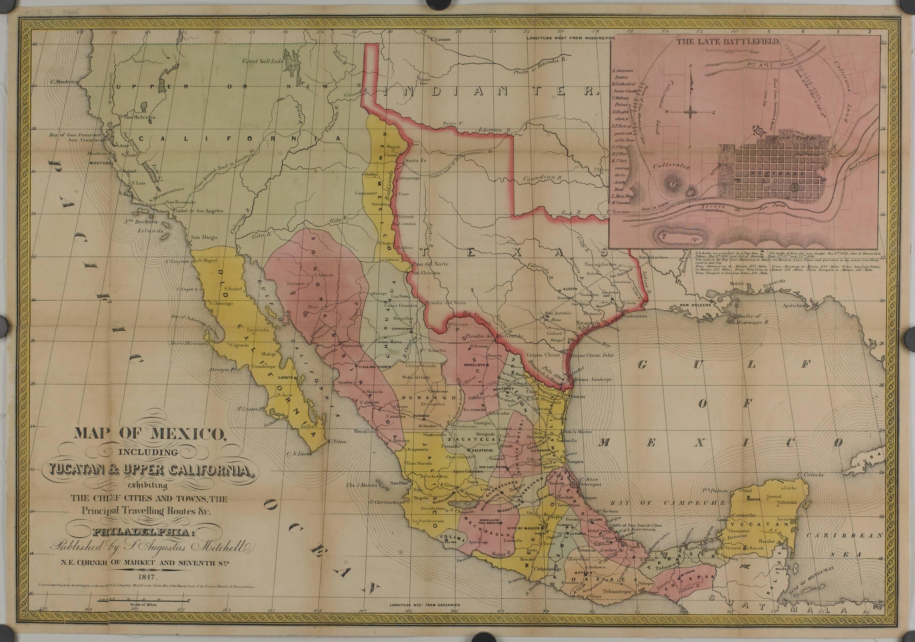
Map of Mexico, including Yucatan and Upper California
Title
Map of Mexico, including Yucatan and Upper California
Creator
Augustus, Mitchell, S (Samuel Augustus), 1792-1868
Subject
Historical Maps
Cartography
Cartography
Description
65.5 x 46 cm. Hand colored lithograph, Texas outlined in red, and with an upper right inset of "The Late Battlefield" (Monterey). Shows Mexican territories, locations of battlefields, major cities, provinces, and land features.
Publisher
Honnold Mudd Library. Special Collections
Contributor
JSTOR
Date
1847
Type
Image
Format
image/jp2
Identifier
mam00057.tif
http://cdm15831.contentdm.oclc.org/cdm/ref/collection/p15831coll14/id/66
http://cdm15831.contentdm.oclc.org/cdm/ref/collection/p15831coll14/id/66
Source
Original map, 13.5 cm: Honnold/Mudd Library map collection m917.72 M695, folder 3:6
Language
English
Relation
Maps and Mapping at The Claremont Colleges - https://ccdl.claremont.edu/digital/collection/p15831coll14
Rights
For more information on copyright or permissions for this image, please contact Honnold Mudd Library Special Collections at https://library.claremont.edu/scl/
Files
Citation
Augustus, Mitchell, S (Samuel Augustus), 1792-1868, “Map of Mexico, including Yucatan and Upper California,” Santa Clara University Digital Exhibits, accessed June 19, 2026, https://dh.scu.edu/exhibits/items/show/2886.
Item Relations
This item has no relations.