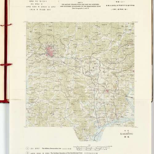
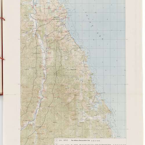
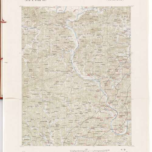
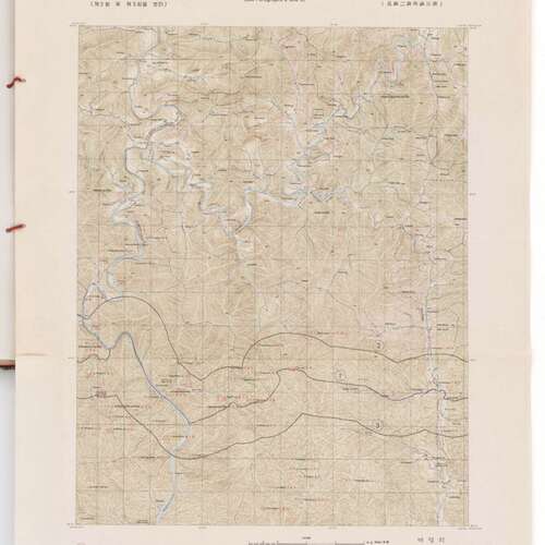
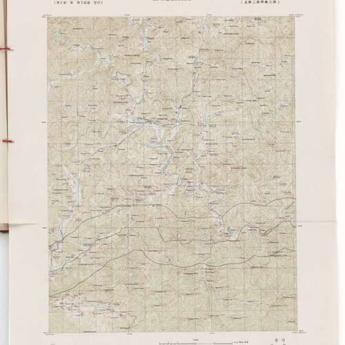
Military Demarcation Line and the Northern and Southern Borders of Demilitarized Zone, Korea
Title
Military Demarcation Line and the Northern and Southern Borders of Demilitarized Zone, Korea
Creator
Records of the U.S. Joint Chiefs of Staff.
Subject
Korean War
Description
These maps show the boundaries of the Demilitarized Zone following the Armistice Agreement at the end of the Korean War.
The middle line (labelled 1) is the military demarcation line showing the border between North and South Korea. The lines on either side (labelled line 2 and 3) are the Northern and Southern boundaries of the Demilitarized Zone (DMZ).
The middle line (labelled 1) is the military demarcation line showing the border between North and South Korea. The lines on either side (labelled line 2 and 3) are the Northern and Southern boundaries of the Demilitarized Zone (DMZ).
Publisher
Records of the U.S. Joint Chiefs of Staff, Record Group 218; National Archives at College Park, College Park, MD.
Date
1953
Type
Image
Identifier
7062614
Source
Military Demarcation Line and the Northern and Southern Borders of Demilitarized Zone, Korean Armistice Agreement Volume 2, Maps ; 1953; Korean Armistice Agreement, 1953 - 1953; Records of the U.S. Joint Chiefs of Staff, Record Group 218; National Archives at College Park, College Park, MD.
Language
English
Rights
Public Domain, Free of Known Copyright Restrictions.
Collection
Citation
Records of the U.S. Joint Chiefs of Staff., “Military Demarcation Line and the Northern and Southern Borders of Demilitarized Zone, Korea,” Santa Clara University Digital Exhibits, accessed January 30, 2026, https://dh.scu.edu/exhibits/items/show/4119.
Embed
Copy the code below into your web page
Item Relations
This item has no relations.
