The continental scale of the Chernobyl accident
Title
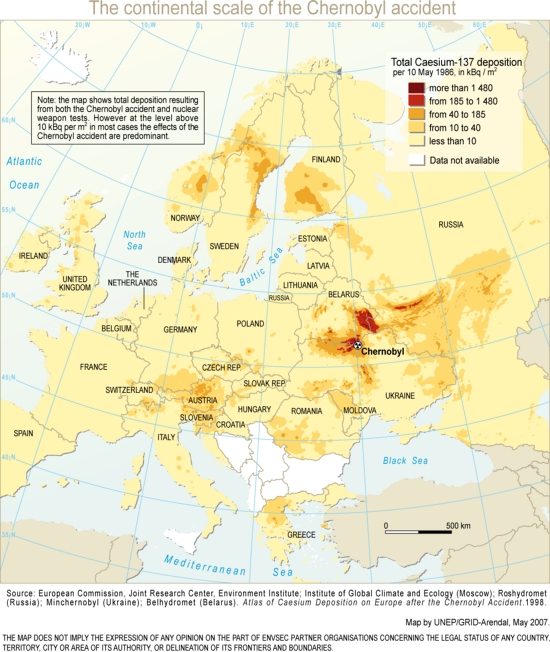
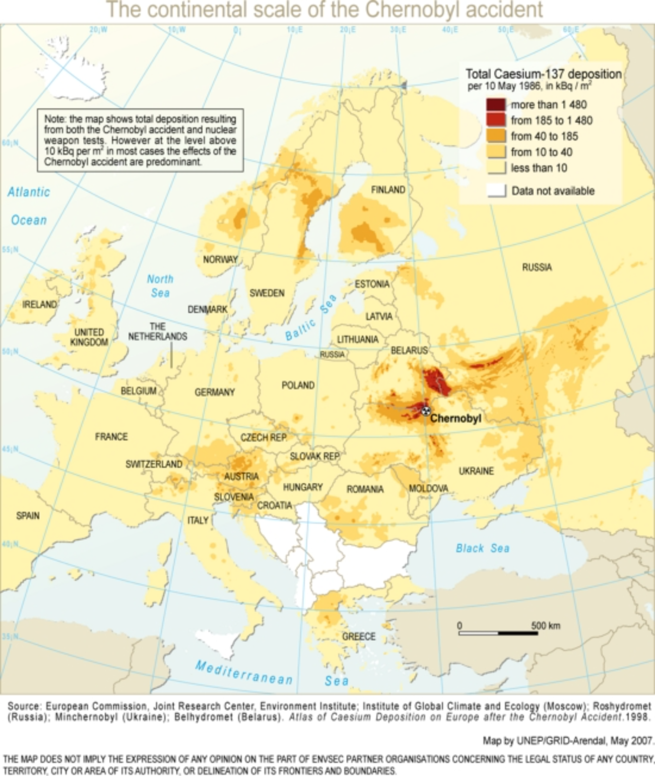
The continental scale of the Chernobyl accident
Creator
Novikov
Subject
Chernobyl radiation map
Description
The accident involving reactor meltdown and massive release of radioactivity occurred on 26 April 1986 at the Chernobyl nuclear power plant situated seven kilometres south of the Ukraine- Belarus border, at the confluence of the Pripyat and Dnieper rivers. Radioactive fallout affected not only Ukraine and Belarus, but also nearby Russia and countries as far away as Sweden and the UK.
Publisher
GRID-Arendal resources library
Date
2007
Type
Image
Format
file format - 248 KB
Source
Collection: Environment and Security: Transforming risks into cooperation - the case of Eastern Europe
https://www.grida.no/resources/7964
GRID-Arendal resources library
https://www.grida.no/resources/7964
GRID-Arendal resources library
Language
English
Rights
Use Constraints
Using this item and referring to it is encouraged, and please use it in presentations, web pages, newspapers, blogs and reports.
For any form of publication, please include the link to this page and give the creator credit (in this case Novikov)
Using this item and referring to it is encouraged, and please use it in presentations, web pages, newspapers, blogs and reports.
For any form of publication, please include the link to this page and give the creator credit (in this case Novikov)
Files
Citation
Novikov, “The continental scale of the Chernobyl accident,” Santa Clara University Digital Exhibits, accessed July 25, 2026, https://dh.scu.edu/exhibits/items/show/5319.
Item Relations
This item has no relations.