Cantino Planisphere
Title
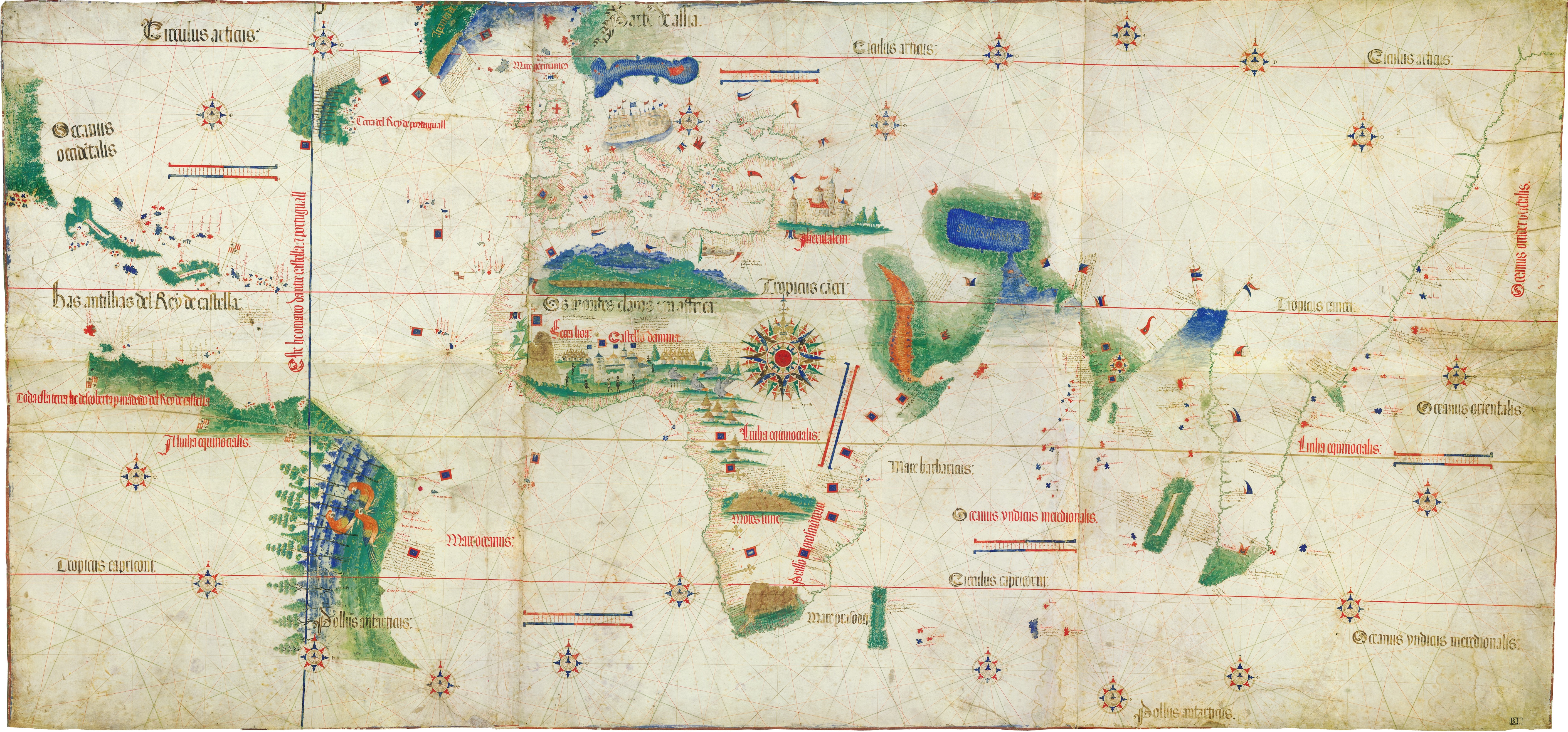
Cantino Planisphere
Creator
Unknown
Description
The Cantino Planisphere is the earliest known European cartographic representation depicting the Americas. Several details merit note, including the Tordesillas line - which divided control over the Americas between Spain and Portugal.
Publisher
https://en.wikipedia.org/wiki/Cantino_planisphere#/media/File:Cantino_planisphere_(1502).jpg
Contributor
Cantino, Alberto
Date
1502
Type
Map
Format
218 x 102 cm
Identifier
Cantino Planisphere
Source
Modena, Biblioteca Estense
Language
English
Rights
Wikipedia, Public Domain
Files
Collection
Citation
Unknown, “Cantino Planisphere,” Santa Clara University Digital Exhibits, accessed July 16, 2026, https://dh.scu.edu/exhibits/items/show/532.
Item Relations
This item has no relations.