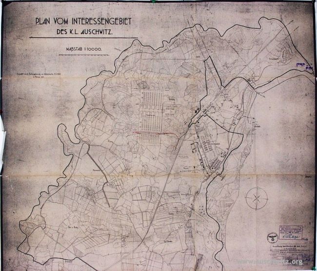
Map of the KL Auschwitz interest zone from February 1941
Title
Map of the KL Auschwitz interest zone from February 1941
Creator
SS
Subject
Auschwitz interest zone
Description
The map of the "KL Auschwitz interest zone" from February 1941. There is also a design of the so-called Schutzhaftlagererweiterung, camp in Birkenau and (marked in red) the side-track of the camp running from the train station in Oświęcim.
Publisher
https://commons.wikimedia.org/wiki/File:Map_of_the_KL_Auschwitz_interest_zone_from_February_1941.jpg
Date
1941-02
Type
Image
Format
jpg
Source
https://commons.wikimedia.org/wiki/File:Map_of_the_KL_Auschwitz_interest_zone_from_February_1941.jpg
Language
German
Rights
Public Domain
Original Format
Map
Physical Dimensions
650 × 556 pixels, cant find physical dimensions
Files
Collection
Citation
SS, “Map of the KL Auschwitz interest zone from February 1941,” Santa Clara University Digital Exhibits, accessed June 20, 2026, https://dh.scu.edu/exhibits/items/show/5785.
Item Relations
This item has no relations.