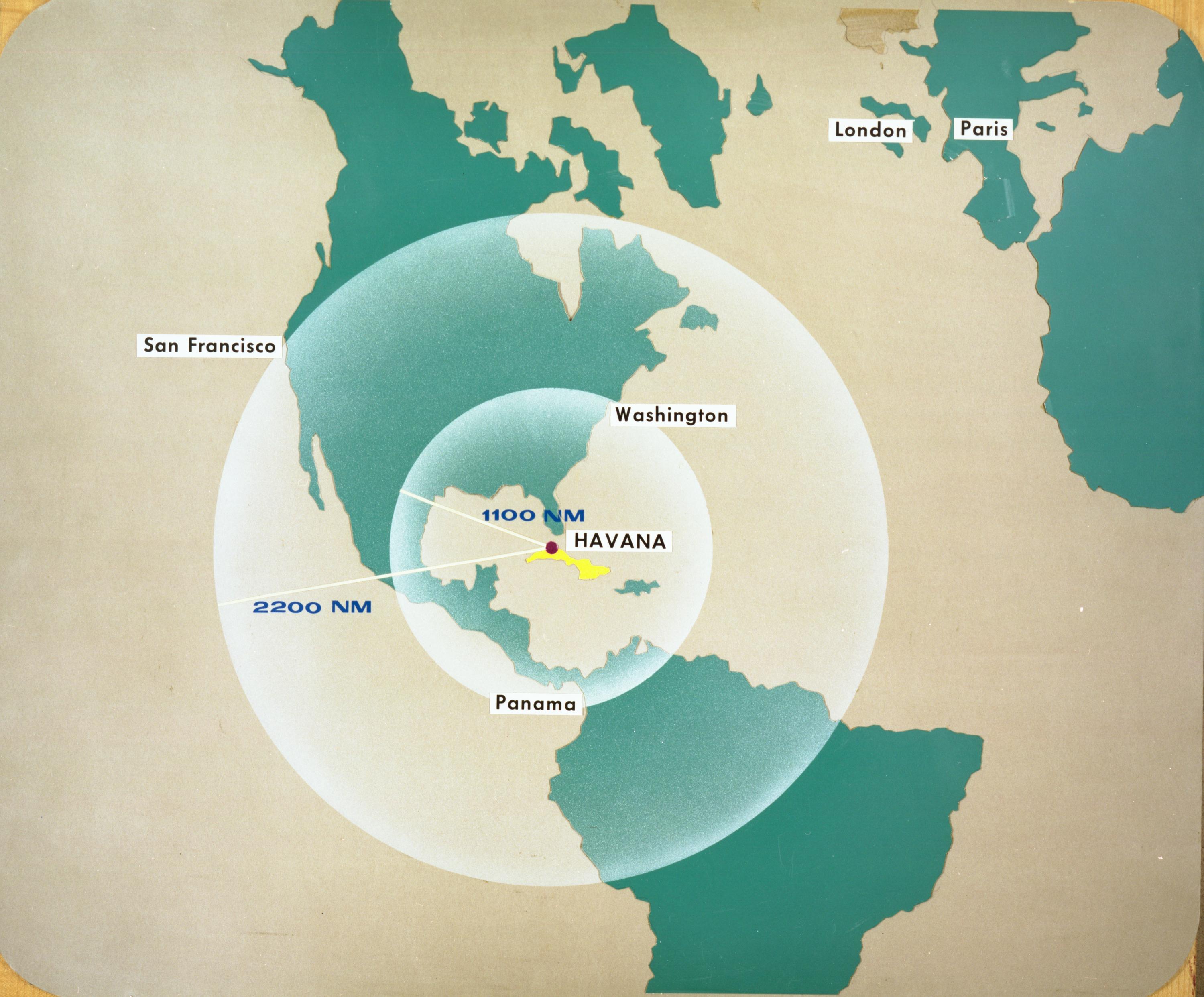
Map of Western Hemisphere showing ranges of 1100 and 2200 nautical miles
Title
Map of Western Hemisphere showing ranges of 1100 and 2200 nautical miles
Creator
United States Department of Defense.
Subject
Cold War
Cuban Missile Crisis
Description
Map of North and South America showing potential ranges of Soviet medium-range (MRBM) and intermediate-range ballistic missiles (IRBM) from Cuba.
Publisher
JFK Library
Date
1962-02-06
Type
Image
Source
https://www.jfklibrary.org/asset-viewer/archives/dodcmcbm-002-004#?image_identifier=DODCMCBM-PX-66-20-13
Files
Collection
Citation
United States Department of Defense. , “Map of Western Hemisphere showing ranges of 1100 and 2200 nautical miles,” Santa Clara University Digital Exhibits, accessed June 20, 2026, https://dh.scu.edu/exhibits/items/show/6086.
Item Relations
This item has no relations.