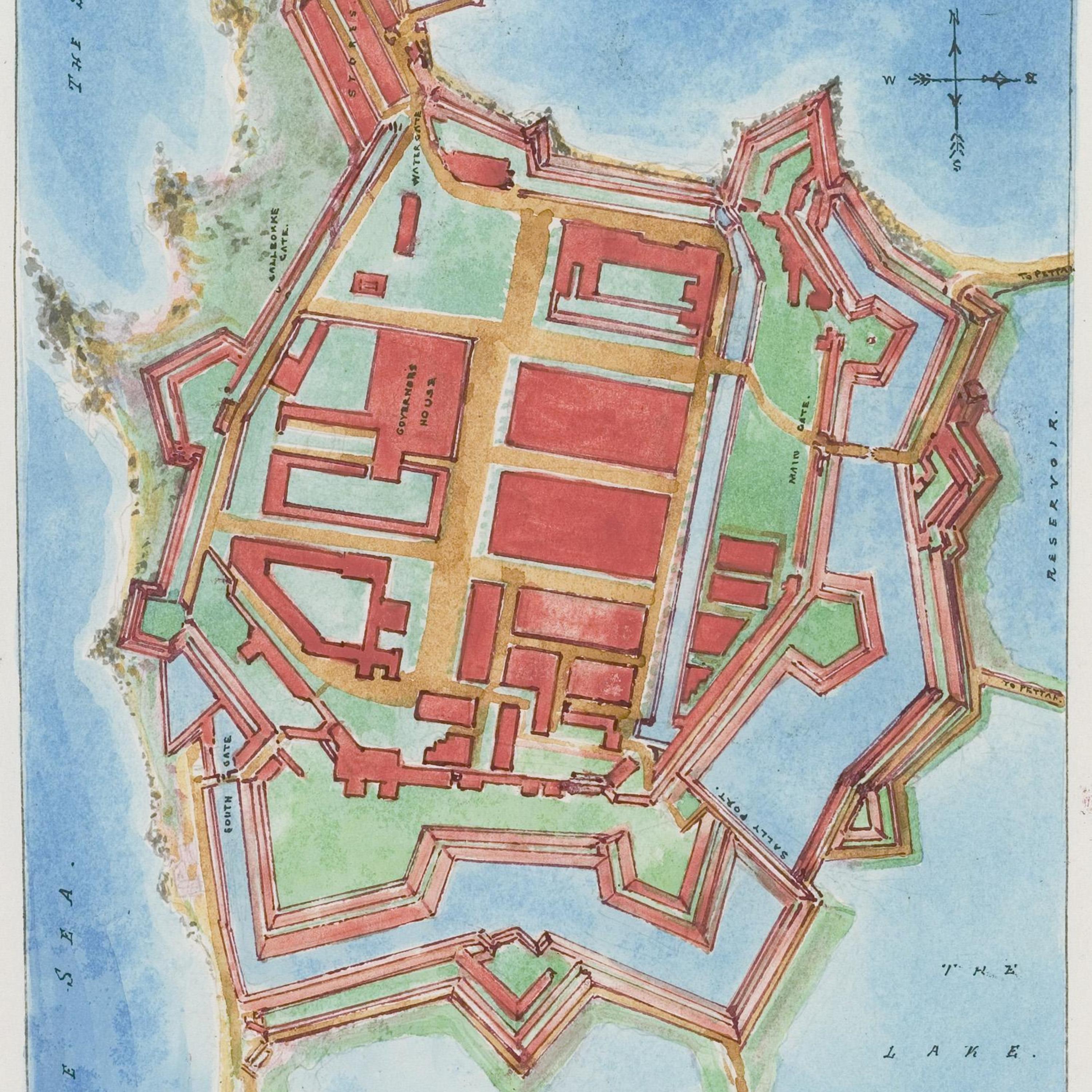
Groundplan of Fort Colombo
Title
Groundplan of Fort Colombo
Creator
van Dort, J.L.K.
Description
The Portuguese arrived in Colombo - on the island of Sri Lanka - in the early 16th century. One of their first activities was to build a fortification to protect their military and merchants. Gasparo Balbi visited the Colombo fort in XXX, 15XX and noted " ....". After the British gained control of Sri Lanka in the 19th century the fort was destroyed, rendering van Dort's illustration a valuable resource to understanding the Portuguese colonial period in this region.
Date
1888
Type
Map
Identifier
Balbi_Colombo_fort.jpg
Source
https://en.wikipedia.org/wiki/Fort_(Colombo)#/media/File:Map_of_Colombo_Fort.jpg
Language
English
Rights
https://en.wikipedia.org/wiki/Fort_(Colombo)#/media/File:Map_of_Colombo_Fort.jpg
Collection
Citation
van Dort, J.L.K., “Groundplan of Fort Colombo,” Santa Clara University Digital Exhibits, accessed January 30, 2026, https://dh.scu.edu/exhibits/items/show/697.
Embed
Copy the code below into your web page
Item Relations
This item has no relations.
