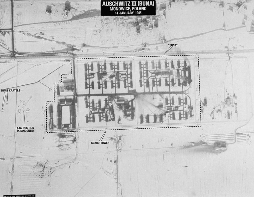
An aerial reconnaissance photograph of the Auschwitz concentration camp showing the Auschwitz III (Buna plant).
Title
An aerial reconnaissance photograph of the Auschwitz concentration camp showing the Auschwitz III (Buna plant).
Subject
Map of Auschwitz III - Monowitz
Description
One of a series of aerial photographs taken by Allied reconnaissance units under the command of the 15th U.S. Army Air Force during missions dating between April 4, 1944 and January 14, 1945. The photos were used to plan bombing raids, determine the accuracy of bombing sorties, or make damage assessments. A typical sortie employed two cameras equipped with lenses of different focal lengths.
After the war the Auschwitz reconnaissance photographs were stored in the archives of the Defense Intelligence Agency (Washington, D.C.) until they were rediscovered in 1978 by two CIA photo analysts, Dino Brugioni and Robert Poirer. The photographs were later declassified and transferred to the National Archives, where they became RG 373. A selection of images were enlarged and annotated with identifying labels by the CIA in 1978.
After the war the Auschwitz reconnaissance photographs were stored in the archives of the Defense Intelligence Agency (Washington, D.C.) until they were rediscovered in 1978 by two CIA photo analysts, Dino Brugioni and Robert Poirer. The photographs were later declassified and transferred to the National Archives, where they became RG 373. A selection of images were enlarged and annotated with identifying labels by the CIA in 1978.
Date
1945-01-14
Type
Still Image
Source
https://collections.ushmm.org/search/catalog/pa21496
Rights
National Archives and Records Administration, College Park
Files
Collection
Citation
“An aerial reconnaissance photograph of the Auschwitz concentration camp showing the Auschwitz III (Buna plant).,” Santa Clara University Digital Exhibits, accessed June 20, 2026, https://dh.scu.edu/exhibits/items/show/5825.
Item Relations
This item has no relations.